Cotoca
Cotoca is a canton and Municipality of Andrés Ibáñez Province in Santa Cruz Department, Bolivia. The municipality consists of two cantons – Cotoca itself and Puerto Pailas. In 2010 it had an estimated population of 23,951 for the canton and 56,451 for the municipality.
In 1799, the Catholic Church authorised the building of a shrine to the Virgen de Cotoca, an image of Mary (mother of Jesus) that was seen in the town. The Virgin is now the patron saint of the entire province of Santa Cruz and her feast from 8 to 15 December draws thousands of Bolivians.
The population increased tenfold in the last forty years:
In the Bolivian regional election, 2010, Cotoca placed the Verdes (Bolivia) party of Governor Rubén Costas first, although by less than the overall result for the province:
Map - Cotoca
Map
Country - Bolivia
 |
 |
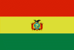
| Flag of Bolivia | |
The sovereign state of Bolivia is a constitutionally unitary state, divided into nine departments. Its geography varies from the peaks of the Andes in the West, to the Eastern Lowlands, situated within the Amazon basin. One-third of the country is within the Andean mountain range. With 1098581 km2 of area, Bolivia is the fifth largest country in South America, after Brazil, Argentina, Peru, and Colombia (and alongside Paraguay, one of the only two landlocked countries in the Americas), the 27th largest in the world, the largest landlocked country in the Southern Hemisphere, and the world's seventh largest landlocked country, after Kazakhstan, Mongolia, Chad, Niger, Mali, and Ethiopia.
Currency / Language
| ISO | Currency | Symbol | Significant figures |
|---|---|---|---|
| BOB | Boliviano | Bs | 2 |
| ISO | Language |
|---|---|
| AY | Aymara language |
| QU | Quechua language |
| ES | Spanish language |


